
Marinus Link Project
Have you heard about the proposed Marinus Link project?
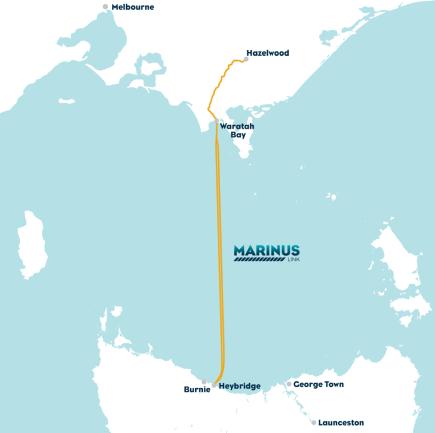
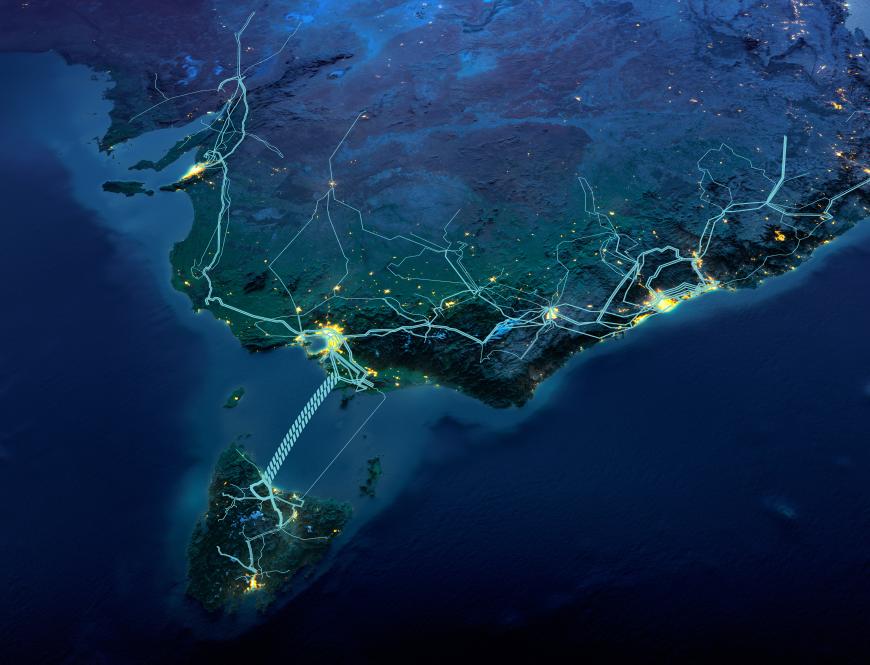
Marinus Link is a planned undersea and underground electricity and internet cable between north west Tasmania and Hazelwood.
The Marinus Link project is being progressed by Marinus Link Pty Ltd (MLPL), which is jointly owned by the Australian, Tasmanian and Victorian governments.
The project will give Victoria energy security during the transition from coal to renewables by improving access to Tasmania’s large hydropower energy storage.
As coal stations retire, solar and wind will be the main replacement energy sources, but there will be times when it is not windy and sunny, and sometimes for long periods. This is where Marinus Link and Tasmania’s unique hydropower will be crucial for Victorians.
Hydropower can plug the gaps, giving Victoria a secure, reliable and renewable energy supply during peak periods of electricity demand (in the evenings and early mornings) or periods of low solar and wind. Additionally, hydropower is a low-cost and low-emissions alternative to gas generation, which can play a similar role of ‘firming’.
Marinus Link will be underground in Gippsland, crossing the shore at Waratah Bay about 3 km west of Sandy Point, running north through South Gippsland and into the Latrobe Valley.
It will connect into the national electricity grid at Hazelwood. A converter station will be constructed at the connection point on Tramway Road in Hazelwood, neighbouring the current Hazelwood Terminal Station.
The cables will be about 345 kilometres long, including 255 kilometres of undersea cables across Bass Strait and 90 kilometres of underground cables in Victoria.
The project will be delivered in two stages. Each stage will deliver one complete 750 MW cable system and converter station in Tasmania and Victoria.
Civil works, trenching and installation of cable conduits and joint pits for both stages will be completed in Stage 1. This will minimise impacts to landholders and the extent of works associated with Stage 2, and provide for the efficient delivery of the second stage at a time determined by market demand.
MLPL’s most recent major milestone was the public exhibition of the project’s Commonwealth and Victorian environmental assessment documents.
The milestone is the culmination of several years’ engagement, surveys, and studies undertaken by technical experts on land and at sea.
The combined documentation for the draft Commonwealth Environmental Impact Statement and the Victorian Environment Effects Statement (EIS/EES) and draft Planning Scheme Amendment (PSA) appeared on public exhibition from May 31 – July 12, 2024.
The combined EIS/EES addresses Commonwealth and Victorian matters, identifies potential impacts, and proposes how the project plans to avoid, minimise or manage them.
During public exhibition, MLPL hosted a series of drop-in sessions throughout Gippsland, including two in Churchill, to answer questions and provide information on the documents, the approvals process and how to make a submission.
Community feedback at these sessions focused on the timing of the project, its connection to other renewable energy projects in Gippsland, the location for the converter station and the range of job opportunities the project may provide.
Summary documents and fact sheets on the EIS/EES process are available on the Marinus Link website: www.marinuslink.com.au/assessment/commonwealth-and-victoria/.