Churchill Guided Historical Walk
Volunteers from the Churchill and District Historical Association will hold the next Guided Walk on Saturday March 21, 2026. Members of the public wishing to participate are asked to meet and be seated inside the Churchill Caf? & Pizza by 10.15am. While walkers are waiting for the Walk to commence, photos by local Field Naturalist Ken Harris of Churchill’s flora and fauna will be shown on the Cafe’s television. This will be followed by photos showing the development of the town.
The Walk is 1.8 kilometres and will take around two hours. The guide for the Walk on March 21 will be Rob de Souza-Daw, a Churchill resident and a member of the Morwell Historical Society.
The following are three commentaries from the predetermined commentary points from the last Walk.
Churchill was established on March 15, 1965 when the name was proclaimed and the town boundaries defined in the Victorian Government Gazette. 2026 will be the 61ST anniversary of the town. Previously the planned town was named Hazelwood but no-one ever lived in the town of Hazelwood as defined as the initial houses had yet to be built. The first family was the Ayres family who moved into their Housing Commission home in October 1965. The second and only other family in 1965 was the Arch family.
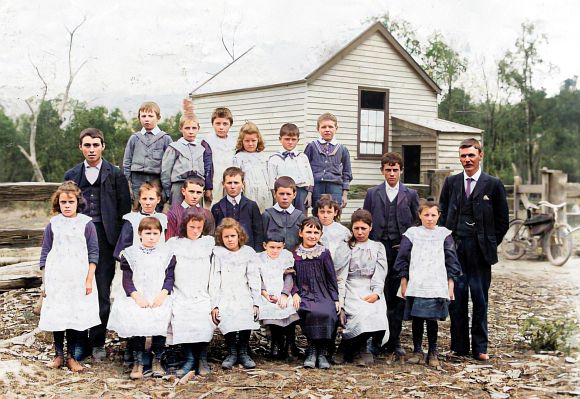
The Eel Hole Creek State School was the first school in what is now Churchill. The school was established as a result of a successful petition of local residents, led by Neil Shaw McDonald requesting a school to be established at Eel Hole Creek. The McDonald family lived where the Glendonald shops are now located. The residents of Eel Hole Creek erected the school building built on land provided by Thomas Full Northway and agreed to provide board for the teacher. The Education Department provided the teacher and the first Head Teacher was William Henry Loftus who opened the school on January 22, 1900. In early 1904, at the request of local residents the school was re-named and became the Hazelwood South State School.

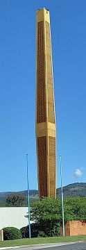
The Churchill Town Symbol was designed and erected at the initiative of the Housing Commission. After a meeting of the Commissioners in early 1967, the Chairman requested Pat O’Neil, Acting Chief Architect to design a symbol for the new town. Pat O’Neil considered that a tall structure was an appropriate design so the symbol could be seem from a distance. The structure was designed to be a geographic locator for the developing town and is not representative of anything. The symbol was initially lit internally with white light but now it is lit externally with coloured lighting. The structure has had several nick-names but Churchill Town Symbol is its original name and in 2022, that name was officially registered as a geographic name. The Latrobe City Council has prepared a design for signage on the structure but has yet to fund the signage.
All Guided Walks are subject to weather on the day. Members of the public are asked to book for the Walk by phoning David McInnes 0400 809 376.